in a perfect world of yancies: June 2011

29 June 2011

Down the Coast III:
Up the Coast

Hiking in Prairie Creek Redwoods State Park
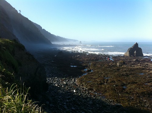
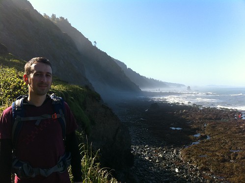
The last leg of our trip took us north from Elk (or is it Greenwood?) and up through more awesome redwoods.

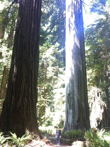
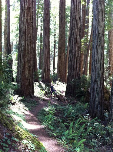
Our first stop was Humboldt Redwoods State Park. Great trees there, and a great interpretive trail.

Deeply moving.

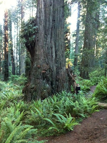
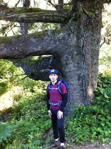
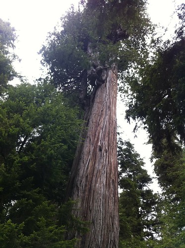
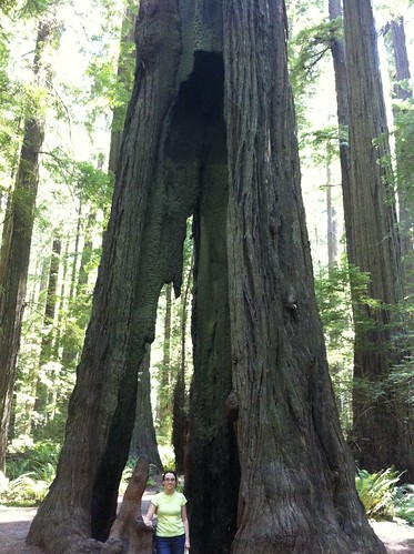
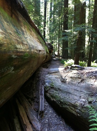
And these tree! This one is doing just fine a hundred or so feet up, despite this damage down below:
These Trees Are Strong

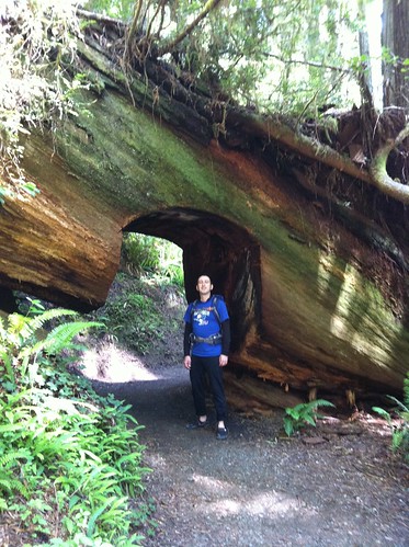
Here's what was once the world's tallest tree:
Dyerville Giant
The Dyerville Giant, "at one time the tallest tree in the world, which fell in 1991 and now provides nutrients to the next generation of trees in the forest," according to the Park's website.

Did I already mention that this place is deeply moving?

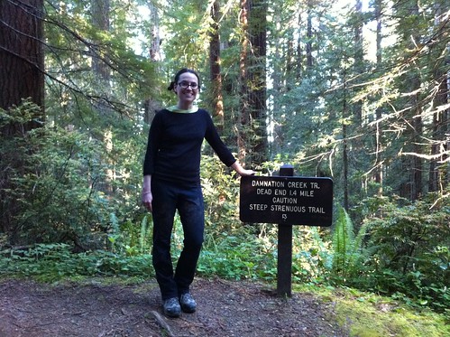
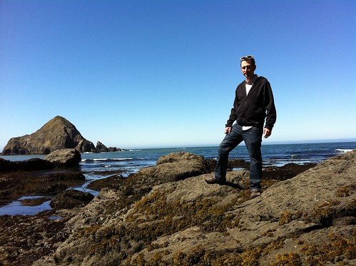
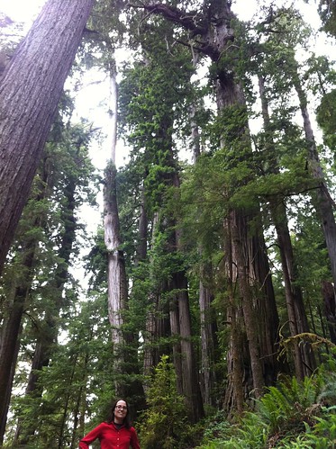
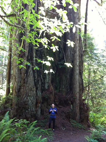
For the sake of scale, I'm standing near the crown, Emily's shooting from the roots:
Yancy and the Dyerville Giant
Can't spot me? Try this blow-up.

Current champion Coast Redwood:
Giant Tree

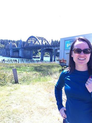
From there we went through Eureka again, and enjoyed a nice meal at the Brick & Fire Bistro.

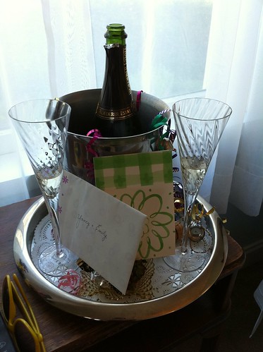
You know what, speaking of food, I forgot to mention something about Elk: while we were there we had the best meal of the whole trip, at the Greenwood Pier Cafe. Delicious.

I seriously am going to have to get back down to Elk again soon!

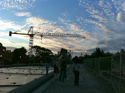
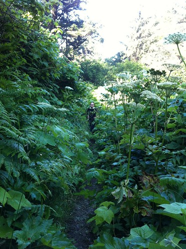
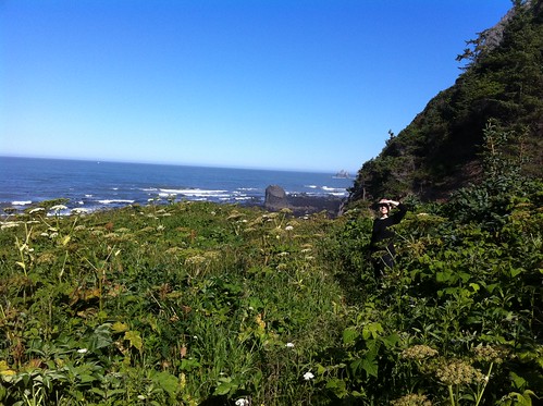
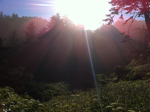
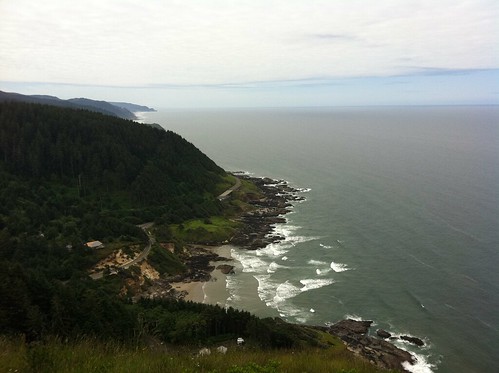
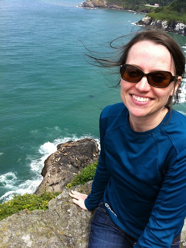
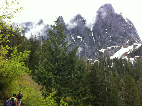
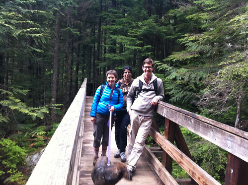
Anyway, next day we did a lovely hike in Prairie Creek Redwoods State Park (also pictured at the top of this post).
Underpass

Here's a little video of the route, recommended by a ranger. Prairie Creek Trail, Zigzag #1, and West Ridge Trail:


Now this is a few trees that have fused together, so it's maybe not crazy as it looks.
Fusion
Still pretty crazy though!

Fused together? Yes, one of the many wild things about redwoods you can read about in this excellent New Yorker piece from '05. Not a subscriber? I hate to encourage this sort of thing, but I noticed a site that posted the story & is trying to claim "fair use"...

Anyway, great read. Hundreds of trunks on the top of one tree? Animals that live their whole lives hundreds of feet above the ground? Trees growing in soil that's formed in the crowns of other trees? Yes. Good stuff.

Okay, where were we?
Oh, speaking of, here's a map of the spots in this post:

View Down the Coast III in a larger map

As you can see, our next stop was Eugene, where we stayed at the lovely C'est la Vie Inn:
C'est la Vie Inn

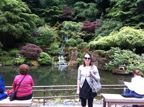
From there we were on the way home, though we couldn't resist stopping in Portland.

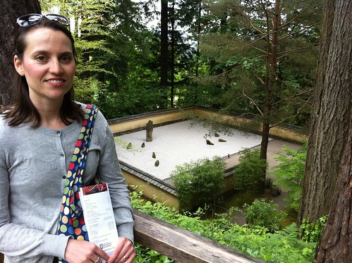
Great Japanese garden. But how did they get the address japanesegarden.com? I mean, that is impressive!
Emily in the Portland Japanese Garden

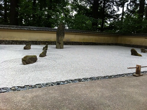
Really liked the rock garden:
Rock and Sand

Above the Rocks and the Sand

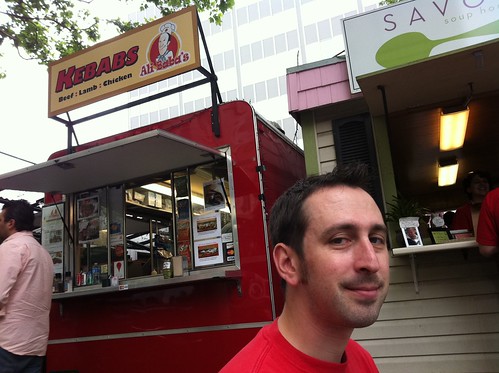
Last stop: Ali Baba's food cart. Yum!
Kebabs!

And then we were home. Which isn't such a bad thing either.
Last Night

27 June 2011

Down the Coast II:
Damnation Never Looked So Good

Great Tree
I mean, look at that tree! You can hardly even see Emily next to it! Amazing stuff.

This leg of the trip started out in Crescent City, which is somewhere in between a working fishing town and a tourist spot (sort of like Newport, actually... pretty cool...). That mix is nicely captured by the Curly Redwood Lodge: it clearly caters to tourists, but it's pretty handsomely low-key. And affordable!

And here's a nice looking salon:
Scissors

Crescent City is also where you'll find the Crescent City Information Center, the main visitor center for Redwood National and State Parks. We stopped there on our way out of town, got some great advice from a ranger, and headed down to Del Norte Coast Redwoods State Park looking for the Damnation Creek Trail.
Smiling in the Face of Damnation
Great hike. Best of the trip, I'd say. (Name's not bad either!)

Begins around 1,000 feet elevation, in redwoods like the one at the top of this post, and then makes its way through probably four different ecosystems, ending with tide pools on the beach. Highly recommended hike.

Here's a map, in case you're interested:

Another Hundred Feet Down, Another Ecosystem
Plus, if you get on the trail at 8am (so that you can be on the beach for low tide), you should basically have the place to yourself.

Yancy, Tree

That tree stands next to this bridge:
Bridge

And right across the bridge, after walking in various forests for a couple of miles, we got to this view:
Seaside

Trail behind us:
Sun on the Trail

Damnation Cove:
Damnation Cove

Yancy at Damnation Cove

After the hike (did I mention that it was great?), we continued down the coast:

View Down the Coast II in a larger map

Made a brief stop in Prairie Creek Redwoods State Park:
In Tall Trees

Our final destination was the Elk Cove Inn. It sounded like a great place when we were making our reservations, but when we hit the first bit of Highway 1 we started to doubt our planning:

View Larger Map
Twenty miles in about an hour! Sheesh! At least it's kind of pretty once you get back to the coast :)

And then we arrived, found out we got an upgrade, saw the beautiful view of Elk Cove, and were greeted by this great surprise in our room:
Great Surprise
So glad we made it down there! My only regret might be that we didn't stay another night!

Yancy at Sunset

After a nice sunset and a good night's sleep, we got to enjoy more beach and tide pool fun at Elk Cove.
On the Beach

Low Tide

Sea Star

Video panorama of the cove:


Can't see the Inn too well, but it's up on the hill behind Emily:
Emily Beneath the Elk Cove Inn
Hope to make it back there soon!

Okay, that seems like plenty for one post. Thanks for reading, and cheers!
Cheers!

24 June 2011

Down the Coast I:
Fun in Perpetua, and More!

E & Y at Yaquina Bay
Amazing last few days! Perfect weather, good food, great hiking... beautiful.

Started out in a yurt at South Beach State Park, in Newport, Oregon.
in the Yurt
Like camping, but without putting up a tent (and it's heated)—not bad at all!

Yurt

Next morning had maybe the best meal of the trip: breakfast at the Coffee House in Newport. Very good crab cakes benedict, and delicious fried oysters, from right there in Yaquina Bay.
Breakfast

Yaquina Bay
Boats in Yaquina Bay

Speaking of geographic features, here's a map of the spots on this first post:

View Down the Coast I in a larger map

As you can see, our next stop was the Cape Perpetua Scenic Area.

Did a great hike, and made a new friend:
Slug

Slug and Yancy

Hike ended at some tide pools, where some helpful rangers showed us some of the sea-life.
Sea Stars
They even encouraged us to touch—turns out sea anemone stingers are sticky, and fast!

Tide Pools

Cool shelter back on top of the Cape, built by CCC crews and still in pretty good shape:
West Shelter

view from Cape Perpetua

Nearby, a view of some sea lions:
Emily and Sea Lions

Stopped for lunch in Florence, where we saw one of the many cool art-deco-meets-Egyptian-ish bridges on Highway 101.
Siuslaw River Bridge
Designed by Conde McCullough.

Also did a quick walk through the Oregon Dunes National Recreation Area.
Yancy in Dunes

Interesting scenery, though I imagine that we'll always remember it for other reasons. Nothing major, but it was the site of the trip's only real mishap...

And then we hit California, and almost as soon as we crossed the border we were surrounded by opportunities to walk right up to trees like these:
Nice Reiterated Trunks
In Jedediah Smith Redwood State Park.

Absolutely amazing.
Emily in Redwoods
More to come!

15 June 2011

Walking, Running, and Dancing

In reverse order (and note, this is only about half of all the crazy busy fun I've been having lately)...

The plot of Giselle sounds a bit over the top, but the Times review was so fascinating, especially all that stuff about old choreography—and balletic mime! So that's how we spent our anniversary.

I'm not sure it was my favorite thing ever (Romeo and Juliet from a couple of years ago still stands out as far as ballet goes), but I really enjoyed it, and the program is full of so much interesting info—I sincerely hope to find time to take a closer look at it :)

And the next day Emily and her teammates reunited and ran in the Briefcase Relay (remember?):
Team Sheep It Up

I'm just glad I was there to get this awesome handoff photo!
Great handoff!
On their way to tenth place! And out of 46—not too shabby!

Finally, in between grading and submitting grades, I joined some friends for a great hike up to the amazing and amazingly cold and frozen Lake Serene.
Water

Wore my finger shoes for the 4.5 miles up, but had to put socks and shoes on once we got to the snowy lake itself...
Mt. Index

Near the Lake

Kascha, Mattie, Anupa and Jerome
Kascha, her dog Mattie, Anupa, and Jerome

Great time, despite my cold toes.

And here's a video of our walk, thanks that awesome Nike+ app:


Okay, soon we'll be off to see the Redwoods. (Map's here, in case you forgot.)

Talk to you soon, reader!